
Brazos Valley Living·Town & Area Profiles·Lake Somerville Area
← Back to Town & Area ProfilesIf you're looking at Lake Somerville, let me give you the plain version from someone who works the area. Lake Somerville is a U.S. Army Corps of Engineers reservoir on Yegua Creek, about 30 miles southwest of Bryan in the Brazos Valley, spanning southern Burleson, northwestern Washington, and eastern Lee counties. Per the USACE Fort Worth District, it covers about 11,460 acres at normal pool with roughly 85 miles of shoreline. The big thing I want you to understand up front is that the lake is federally managed, so true lakefront works differently here than on a private lake. I cover the Burleson County side of the lake regularly, and I'll tell you straight what's available and what the boundary actually allows.
Where Lake Somerville sits
Let me place it for you. Lake Somerville is an impoundment of Yegua Creek in the Brazos River basin, and the U.S. Army Corps of Engineers, Fort Worth District, built it in the 1960s to control flooding in the Yegua watershed. The Texas State Historical Association's Handbook of Texas puts the lake about 30 miles southwest of Bryan, across southern Burleson, northwestern Washington, and eastern Lee counties. The dam sits roughly two miles south of the town of Somerville, and from College Station the town is about 26 miles by Farm to Market Road 60, so for most of my buyers the lake is under a 40-minute drive from Bryan/College Station. The county seat, Caldwell, is a short drive north, and I keep full profiles on both towns for you. The Burleson County shore, on the north and east side of the water, is the part of the lake I work most.
Who and what is at the lake
Lake Somerville is an area, not an incorporated town, so there's no city population to quote you the way I would for Caldwell or Somerville. What sits around the water is a mix of public parkland and lake-area communities. The U.S. Army Corps of Engineers manages the lake itself, and Texas Parks and Wildlife runs Lake Somerville State Park and Trailway around two main units, which I cover below. On the Burleson County side, near the Birch Creek area, you'll find lake-area subdivisions like Birch Creek Forest and Birch Creek Village, platted communities of lots and small acreage a short drive from the water rather than a single town center. For population context, the nearest incorporated town is Somerville, which the U.S. Census counted at 1,312 residents in 2020, and all of Burleson County was 17,642 at that same count. If you want current numbers for a specific subdivision near the lake, just ask me and I'll pull what's available.
Schools around the lake
School districts around Lake Somerville depend on which side of the water and which community a property sits in, and I'll give you the facts without rating or ranking anything. The Burleson County shore near the town of Somerville falls in Somerville Independent School District, which serves grades PK through 12. Other lake-area parcels can fall in neighboring Burleson County districts or, on the Lee and Washington County sides, in different districts entirely, so the district that goes with a specific lot is something I confirm property by property. Texas assigns each district an A through F accountability rating, and because those grades change from year to year, I'd point you straight to the state's TXschools.gov for the current district and campus ratings, and I'll verify the exact district and attendance zone for any address you're considering at the lake.
What I see around Lake Somerville
Real estate around Lake Somerville is mostly a land-and-lake-area story, which happens to be my lane. The most important thing I tell every lake buyer is the difference between lakefront and lake-area property here. Because the Corps owns and manages Lake Somerville, the shoreline is federal land. The USACE Fort Worth District holds two kinds of interest at the water: fee lands, which the government owns outright, and flowage easements, which are privately owned tracts where the government bought the perpetual right to flood up to a set elevation, with restrictions on how that land gets used. So when a listing says lakefront near Lake Somerville, it rarely means a deed that runs to the open water. It usually means land that backs up to the Corps boundary, and exactly what you can build, dock, or do at the water's edge depends on the survey, the fee line, and any easement. Step back from that boundary and the inventory is lake-area property: subdivision lots, country homes, acreage tracts, and recreational land across southern Burleson County within a short drive of the lake. Because I'm with Home & Ranch Real Estate, most of what I work here is land and acreage rather than waterfront condos. I can't promise you what any tract will do in value, but I'll tell you honestly what's available, check the lake boundary, and walk the property with you.
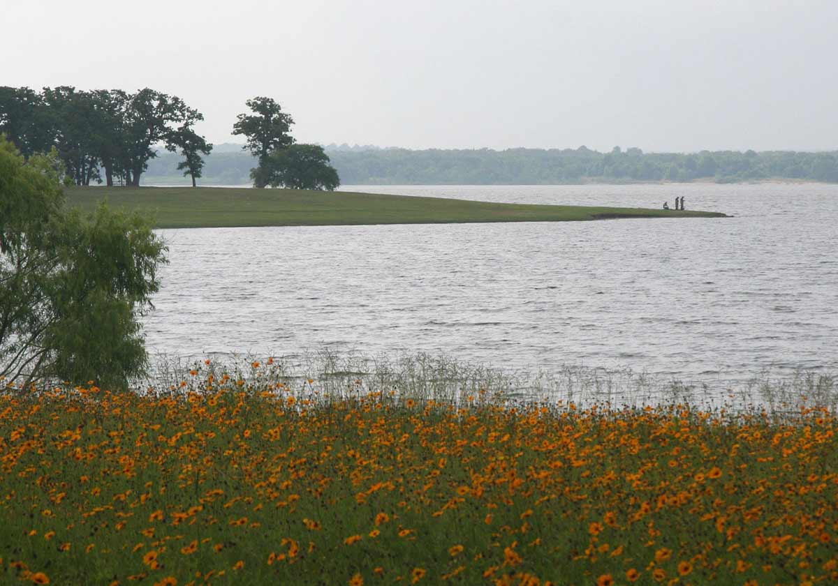
What the lake is known for
The main draw is the water and the parkland around it. Lake Somerville State Park and Trailway, run by Texas Parks and Wildlife, is built around two units: Birch Creek Unit on the north shore in Burleson County, and Nails Creek Unit on the southwest side in Lee County. A trailway of roughly 13 miles connects the two units, open to hikers, mountain bikers, and horseback riders, with equestrian campsites along the way, which is part of why this lake draws the horse-and-trail crowd I work with. The Corps also operates day-use and camping areas around the lake, and the City of Somerville runs Welch Park near town. The lake is known for fishing, boating, camping, and birding across its roughly 85 miles of shoreline. If a property's appeal to you is the trail access or the boat ramp nearby, that's exactly the kind of detail I check before you ever write an offer.
The Lake Somerville market
Prices and inventory around Lake Somerville move month to month, so rather than quote you a number that's stale by the time you read it, I keep current Burleson County and lake-area figures on my monthly market updates. Lake-area parcels also carry their own questions about access, the Corps boundary, and easements that a raw price never captures, so take a look at the updates for the latest, or reach out and I'll send you what fits what you're after and walk the details with you.
Lake Somerville, answered
01 Where is Lake Somerville and how big is it? +
Lake Somerville is a U.S. Army Corps of Engineers reservoir on Yegua Creek, about 30 miles southwest of Bryan in the Brazos Valley. It spans southern Burleson, northwestern Washington, and eastern Lee counties. Per the USACE Fort Worth District, the lake covers about 11,460 acres at its normal pool of 238 feet and has roughly 85 miles of shoreline. I work the Burleson County side of the lake most.
02 What is the difference between lakefront and lake-area property at Lake Somerville? +
Lake Somerville is federally managed, so the shoreline itself is public land the Corps owns or holds a flowage easement over. That means almost no property deeds run to the open water the way they might on a private lake. When you see "lakefront" near Lake Somerville, ask me to check exactly what the survey, the Corps fee line, and any flowage easement actually allow before you assume you can dock or build at the water. "Lake-area" property sits in the communities and acreage around the lake without touching that federal boundary. I walk this line on every lake-area listing.
03 What are the Birch Creek and Nails Creek units at Lake Somerville? +
They are the two main units of Lake Somerville State Park and Trailway, run by Texas Parks and Wildlife. Birch Creek Unit sits on the north shore in Burleson County, and Nails Creek Unit sits on the southwest side in Lee County. A trailway of roughly 13 miles connects the two units, open to hikers, bikers, and horseback riders. Several lake-area subdivisions in Burleson County sit near the Birch Creek side, and that's the part of the lake I cover most.
04 Are there land and lake-area homes for sale around Lake Somerville? +
Yes. Around Lake Somerville in Burleson County you'll find lake-area subdivisions, acreage tracts, country homes, and recreational land within a short drive of the water. What's available changes constantly, and lake-area parcels carry their own questions about access, the Corps boundary, and easements. Tell me what you want near the lake and I'll pull current listings that fit and walk the details with you. I work a lot of land around the lake through Home & Ranch Real Estate.
05 Is the land around Lake Somerville a good place to buy? +
Whether it fits you is your decision, and I'll give you the facts to make it. The Lake Somerville area runs from small lake-area lots to acreage and recreational tracts across southern Burleson County, with the town of Somerville and the county seat of Caldwell both close by. I can't promise what any tract will do in value, but I'll show you what's available, check the lake boundary and access, and give you honest specifics on each property.
The lake, parkland, school, and community facts on this page come from public sources and were current when I wrote it. I describe places and report figures with their source; I do not rate or rank schools or communities. Lake boundaries, easements, ratings, and figures change, so check the source directly for the latest and confirm any specific property's details with a current survey and the managing agency. This page is general local information, not legal, tax, or financial advice.
Sources
- Lake size and shoreline: U.S. Army Corps of Engineers, Fort Worth District, Somerville Lake information (normal pool elevation 238.0 feet, about 11,460 acres, approximately 85 miles of shoreline). Other agencies report slightly different surface-area figures (Texas Water Development Board about 11,456 acres; the TSHA Handbook of Texas about 11,160 acres at conservation elevation); this page uses the USACE Fort Worth District figure.
- Location, counties, Yegua Creek, construction, and flood-control purpose: Texas State Historical Association, Handbook of Texas (Somerville Lake) (about 30 miles southwest of Bryan; southern Burleson, northwestern Washington, and eastern Lee counties; dam two miles south of Somerville; built by the USACE Fort Worth District, begun 1962, completed 1967, dedicated May 17, 1968).
- Lakefront vs lake-area / land interests: USACE Fort Worth District, Somerville Lake real estate, describing federal "fee lands" the government owns outright and "flowage easement" lands that are privately owned with use restrictions and a perpetual government right to flood to a set elevation.
- State park and trailway: Texas Parks & Wildlife, Lake Somerville State Park & Trailway (Birch Creek Unit on the north shore, Nails Creek Unit on the southwest side, connected by a trailway of about 13 miles).
- Population context: U.S. Census Bureau, 2020 Census, Somerville city 1,312 (1,376 in 2010) and Burleson County 17,642 (via Wikipedia, Somerville, Texas). Lake-area subdivisions (Birch Creek Forest, Birch Creek Village) per the Burleson County Chamber of Commerce.
- Schools: district and grade span for Somerville ISD via the NCES Common Core of Data. Current accountability ratings: TXschools.gov.
Thinking about Lake Somerville?
My office is up the road in Caldwell, and I cover the Burleson County side of the lake regularly. Call or text and I'll tell you straight what's available and what the lake boundary actually allows.